Mawdesley Village
Mawdesley is a tranquil village, enjoying a picturesque setting amidst fields and trees. It has charming homes, three churches, pubs, a fabulous village hall, a first-class cricket ground and a busy social life. Mawdesley offers fresh air, friendly folk, and a slower pace of life.
Mawdesley thrives on its foundations of strong family and community values and does so to make the village appealing to all who live, work and visit. We have some of the best village facilities around, with numerous community events, and many thriving clubs and organisations all propped up by local volunteers. These things all combine to enrich and improve our quality of life. Mawdesley remains a place with a heart and villagers know how to come together. It is also home to two primary schools and three churches.


The name Mawdesley is thought to have originated in the reign of Edward I (1272–1308). The suffix -ley describes a field, meadow or clearing. Records show that a manor existed in 1250 AD on the site of the present Mawdesley Hall.
Mawdesley Hall is a small hall on a back road leading into the village. It was built by William Mawdesley in 1625, but altered towards the end of the 18th century.[
Croston
Croston settlement predates the 7th century when St Aidan (supposedly, but certainly his monks) established the Christian religious centre here by having a cross erected. Hence the village's name.
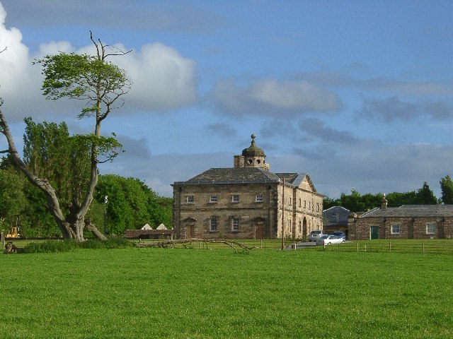
Here is an image, thanks to British History Online, which shows the extent of Croston Parish
Another line of research is the family De Trafford one of whom fought against the Normans in 1066.
The family has direct links to the Manchester Traffords but, sadly, the Croston branch no longer exists

Eccleston

Its name came from the Celtic word "eglēs" meaning a church, and the Old English word "tūn" meaning a farmstead or settlement, i.e. a settlement by a Romano-British church.[1] Evidence of the settlement dates back hundreds of years; St. Mary's Church dates back to the 14th century AD.[2]
The village was mentioned in the Domesday Book of 1086, the book ordered by William the Conqueror, to detail all settlements and farms in England for the purpose of tax collection.
Rufford
Rufford is a village in West Lancashire, England, where the Leeds and Liverpool Canal, Liverpool, Ormskirk and Preston Railway, the A59 and the River Douglas meet.
Rufford is also a civil parish, which includes the neighbouring village of Holmeswood,[1] and in 2011 had a population of 2,049.
Rufford's name derives from the Old English rūh and ford, the rough ford.[3] It was a crossing place over the River Douglas.

Bretherton

Bretherton is a small village and civil parish in the Borough of Chorley, Lancashire, England. With a population of around 669 people, according to the 2011 census, it is a close-knit community with a rich history dating back to the pre-conquest era. The village’s name, Bretherton, derives from either the Old English brothor and tun or Norse brothir and means “farmstead of the brothers”. It was first recorded in documents in 1190.
The village’s name suggests pre-conquest origins, and its early history was closely involved with the manor house Bank Hall and the families who lived there. The manor house, which dates back to the 16th century, is now a private residence
Longton
Longton is a small rural community in the west of South Ribble and a village of ancient origin. The parish church, St Andrew's, was completed in 1887, but there is a record of a chapel on the same site as long ago as AD 1150. A document refers to 'Eaford priest of Longton' of that date.
In addition to Longton, Hutton, Hoole & Much Hoole are also small villages located in the rural Western Parishes of South Ribble. Each village has their own characteristic centres where you will find a range of unique and independent shops, tea rooms and local pubs. Located nearby is the Ribble Estuary, which is an exceptional place for bird watching, the sandflats support different birds such as Bar-tailed Godwit, Knot and Sanderling enthusiast or novices will thoroughly enjoy the spectacle that is unique to the area!

Wrightington

Wrightington lies to the east of the district and is mostly hilly, rising to a height of 500 feet at Harrock Hill. It contains some of the finest country scenery in the whole for south Lancashire and a very fine panoramic view of the west Lancashire plain is seen from Harrock and Hunters Hills. Wrightington has three villages: Appley Bridge, Mossy Lea and Hilldale along with the hamlet of Andertons Mill. Wrightington was, in early medieval times, part of the Barony of Manchester.
It is the site of the world famous orthopaedic hospital
Tarleton
Tarleton is a village and civil parish in the West Lancashire district of Lancashire, England. It is situated approximately 19 miles (31 km) north-east of Liverpool and 9 miles (14 km) south-west of Preston. The parish includes the village of Mere Brow and the hamlets of Sollom and Holmes, and is an agricultural area. It had a population of 5,959 at the 2021 Census.[1] Tarleton village, Holmes, and the villages of Hesketh Bank and Becconsall to the north form a single built-up area with a population of 8,755.[2]. Tarleton is derived from the Old Norse Tharaldr, a personal name and the Old English tun, a farmstead or enclosure.[3] The township was recorded as Tharilton in 1246 and subsequently Tarleton.[4] Tarleton is mentioned in the Feet of Fines in 1298.[5]

Burscough

Burscough, located North of Ormskirk in West Lancashire is a thriving community village. This small village is home to Hamlet of Talscough and Burscough wharf.The Leeds and Liverpool canal passes through the parish, along with several rail lines. Burscough has a great agricultural tradition with more farms, farmed land and agricultural employment than any of its neighbouring districts. For those who are interested in history, Burscough Parish Church was one of the Million of Waterloo churches built as a thanksgiving after the final defeat of Napoleon in 1815.
Burscough is also home to the Wildfowl and Wetland Trust's reserve at Martin Mere, a site of specific scientific interest and a major attraction for the North West of England. It is also home to Windmill Animal Farm , a working farm offering visitors the chance to watch, feed and touch the animals.
Lathom
Lathom (/ˈleɪðəm/)[1] is a village and civil parish in Lancashire, England, near Skelmersdale, about 3 miles (5 km) east of Ormskirk. It is in the district of West Lancashire, and with the parish of Newburgh forms part of Newburgh ward. The population of the civil parish at the 2011 census was 914.[2] The Leeds and Liverpool Canal passes through the parish of Lathom.
Lathom was recorded as Latune in the Domesday Book in 1086, Lathum in 1200, and Lathom in 1223 after which it was the usual spelling.[3] It derives from the dative plural of Old Norse hlaða, a barn. Lathom thus means at the barns.
Lathom is the location of Lathom House built in the Middle Ages, seat of the de Lathom and Stanley families, twice besieged during the English Civil War and subsequently bought by Sir Thomas Bootle who restored the ancient mansion. It passed through his niece to Richard Wilbraham and their son, Lord Skelmersdale. The main block was demolished in 1925.[6]